Journey Map NZ

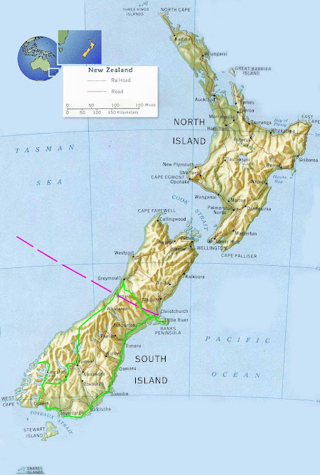
Journey Map NZ

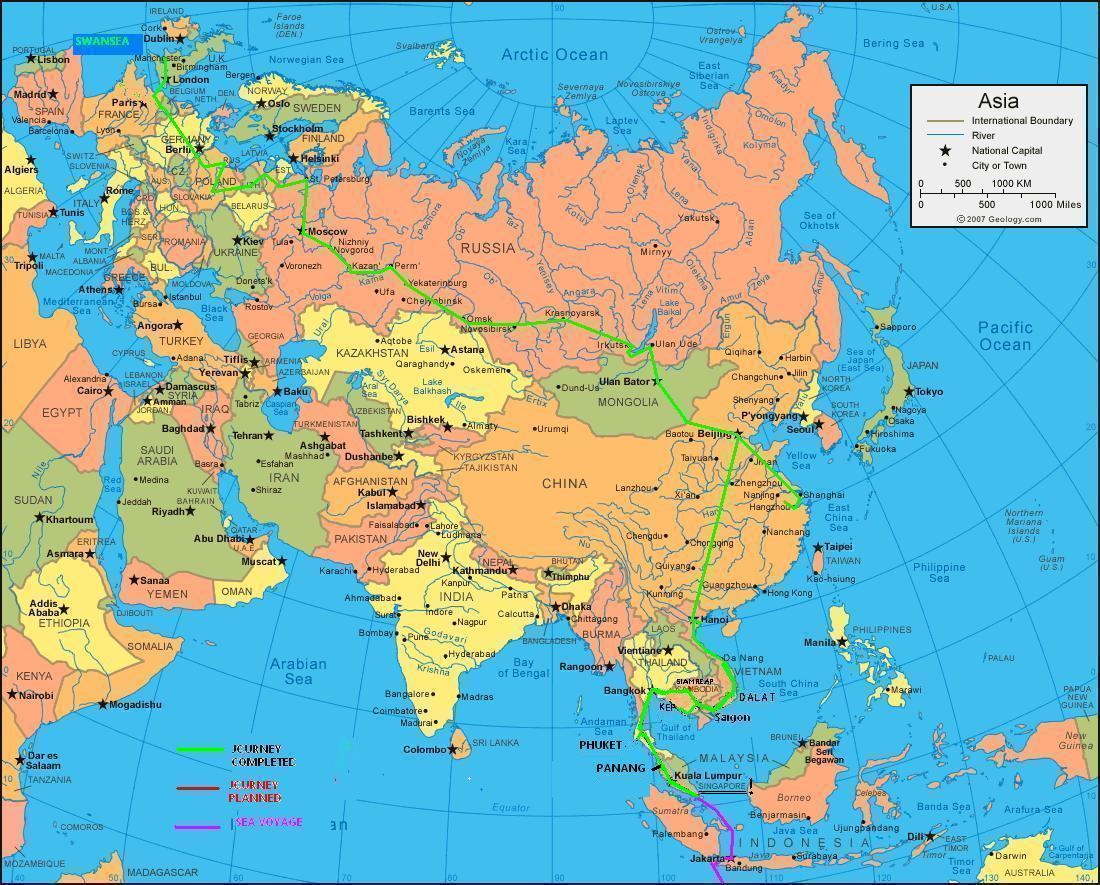
Journey map - oz

Journey map - oz

Journey Map

Journey Map

Tuesday, 19 October 2010

Mavora Lakes Part 1

First trip out in the new Landy, packing to go. Ruby the cat was keen so we stashed her in the cab.
Up the track by North Mavora Lake. Time to remove the tow bar as she was narrowing the exit angle.
View up the track to the confluence of the Mararoa River and the Windon Burn

Having a play in the mud
River crossing #1 All good so far
2 rivers later, at Forks hut. 3 trucks, 6 guys and a lot of beer and coal.
Next morning the river was up.
Needed some help from the winch. However just succeeded in winching a few boulders towards the river. Once hypothermia was approaching we returned to the hut and warmed up.
We took the decision to walk out. This is half way down.
Luckily a kilo of cheese some salami and a 25km walk later we were still smiling!The relief vehicle - a Toyota Corona. 7 of us squeezed in and planned the recovery for the next day.

To be continued...!

Monday, 13 September 2010

The Routeburn

Just over an hour from Queenstown is the Routeburn track, a several day hiking route through forest and mountains. It begins at the top of Lake Wakatipu and follows the Routeburn river in the Mount Aspiring National Park to the Fiordland National Park in the West. It is approx 35kms long and there are several huts to sleep in along the way which are maintained by the Dept of Conservation. It's a shame the weekends are not longer but e made it to the first hut for a short weekend break.

Routeburn Flats hut.
Dinner in the hut. No electricity so wod fire, candles and pasta!
Excited to be having breakfast in the unspoilt countryside with not another soul for several kilometers. Just a few Paradise shelducks for company.
Morning cloud.
Forest moss on an old tree stump.
The trees are predominantly mountain beech and red beech.

There is plenty of water around including this attractive cascade.
The water was some of the clearest I have seen.
Fungi.

Sunday, 5 September 2010

Riverton bike ride and the Keppler track tramp

Marjan from Austria and I cycled from Invercargill to Riverton, about 38kms away.
There is a local sculptor who made this stag in the river...
...and this bird perched on a pole. On the left in the water is a maimai - duck shooters hideout.
The garage at home. Fishing rods, bikes and a couple of sheep hanging before being frozen.
A few of us from the hospital made a trip to Te Anau to do the first part of the Keppler track. We hired a helicopter to take a load of coal, food and beer up to the top of the mountain while we walked up. The weather on the way up was glorious.
Lake Te Anau from Brod Bay

Limestone cliffs.
The snowline.


View from above the treeline to Lake Te Anau


Luxmore hut - the accomodation for the first night of the Keppler track.
Relief as we reach the hut.
Whitebait patties - tasty treat.
The dinner.
A good coal fire kept us warm.

Monday, 16 August 2010

More out and about in Southland

One of my friends at the SPCA - Roger
Riding on Oreti Beach


Heading fishing at Colac Bay
Riverton on the Aparima river
Looking West from More's reserve to Colac Bay
I've been settling in Southland so not so much in the way of photos to be shown but the weekends are proving productive with so much countryside around.
Hopefully I'll be exploring on 2 wheels soon as my bike is nearly ready for some pedaling action!

Wednesday, 14 July 2010

Some shots of Southland

Here are a few shots of my adopted region for the next few months, hopefully.

Bluff Harbour from Bluff Hill lookout. Looking roughly East.
Bluff is a small Port town at the Southern tip of the New Zealand mainland. Famous for it's oysters it also serves as a ferry terminal to Stewart Island. There is a very large Aluminium plant across the water on Tiwai Point. This has it's own jetty on which a large bulk carrier ship has docked on the left of the frame. Bauxite (Ore) comes from Queensland, Australia.

Due to the large amounts of electricity required to produce Aluminium a hydro electric power station was built a few hundred kms away near Lake Manapouri as a joint project.
Not far away is the sleepy hamlet of Omaui. Abalone shellfish or 'Paua' as the locals call it can be harvested here at low tide but there are strict quotas and size regulations. No more than 1o per person per day and all over 125mm long
Invercargill fashion.
The Oreti River.
Diffuse rainbow at Sandy Point (Opposite Omaui)

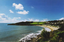
Langland, Swansea

Langland, Swansea

Fiordland, NZ

Fiordland, NZ